
360 Tours
One of our many services which we are seeing clients find very useful for their projects are 360 tours
An Overview
The 360 tours can immerse the viewer into the location by adding points of interest, zoom points, additional 360 tours at points of interest, videos etc. These are great dynamic images to showcase a project in as many dimensions as we can possibly imagine.
How It Works?
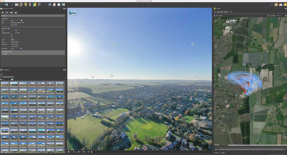
The drone is flown and strategically placed in a good central location to capture the area within its 360 panoramic view. We then proceed in capturing a row of photographs overlapping each photo with the previous until will arrive again where we started. We then raise the camera angle upwards to capture another row of photographs as we did the previous row and so on until we finish lastly with the camera looking directly downwards to finish the various rows of photographs with the drone most importantly always in the same fixed position.
We proceed to upload the images to our workstation and then pass the images to our 360 panoramic software which allows up to stitch all images seemlessly, create tours, add additional elements, add additional 360 tours within the main tour and so on. These functions are ideal for places of interest, developments, golf courses and a lot more.
Equipment used
Depending what output is required, our equipment here consists of
- Mavic 3 pro, Air 2s, Insta360 Sphere
- Lightroom
- Specialised 360 software