
Orthomosaic Drone Mapping: A New Perspective in Construction
The construction industry is always in search of innovative tools and methodologies to streamline workflow and enhance efficiency. One technology that is becoming increasingly popular in this sector is orthomosaic drone mapping. With this cutting-edge tool, construction professionals can gain a new perspective on their projects, helping to drive more accurate planning, faster execution, and ultimately, superior results.
Understanding Orthomosaic Drone Mapping
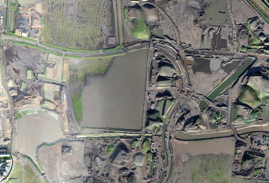
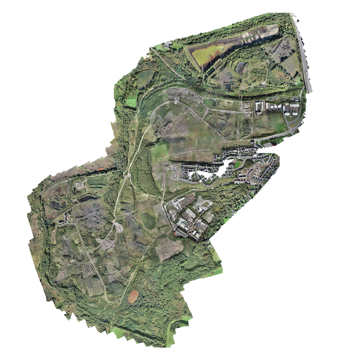
Orthomosaic drone mapping, a pioneering tool in the construction industry, employs drones, or unmanned aerial vehicles (UAVs), outfitted with advanced, high-resolution cameras. These drones fly over designated areas, taking numerous overlapping images from various angles. Using a technique known as photogrammetry, these images are meticulously pieced together to produce an orthomosaic map. This map presents a highly detailed, precise, and high-resolution 2D depiction of the area that has been surveyed.
In contrast to conventional aerial or satellite imagery, orthomosaic maps eliminate perspective distortion, providing precise distance and area measurements. They also offer enhanced clarity and detail, setting them apart as a crucial resource for a wide array of applications in the construction field. The specificity of detail provided by these maps, combined with their inherent accuracy, positions them as an indispensable tool for architects, engineers, and construction project managers. As such, orthomosaic drone mapping is fast becoming a standard practice in modern construction, redefining traditional approaches to project planning, execution, and monitoring.
Applications of Orthomosaic Drone Mapping in Construction
Orthomosaic drone mapping is steadily reshaping construction project management and execution. The applications of this cutting-edge technology in the construction sector are extensive:
1. **Site Planning & Design**: By using orthomosaic maps, architects and engineers can gain a better understanding of the construction site’s topography. This insight assists in the development of building designs and infrastructure that are congruent with the landscape.
2. **Project Monitoring & Progress Reporting**: With drone mapping, the progress of construction projects can be tracked in real-time. This remote access to site progress allows stakeholders to quickly identify and rectify any potential issues, facilitating smoother operations.
3. **Stockpile & Volume Measurements**: Construction often requires precise volume calculations of stockpiles, excavations, and fills. Orthomosaic drone mapping expedites this process, providing quick and accurate measurements.
4. **Quality Control & Inspection**: Detailed inspections of the construction site can be conducted using high-resolution orthomosaic maps. This aids in identifying potential issues and ensuring that high quality standards are consistently met.
These varied applications demonstrate the value of orthomosaic drone mapping within the construction industry, showing its ability to streamline processes, increase accuracy, and improve overall project management.
Advantages of Using Drones for Orthomosaic Mapping
Utilizing drones for orthomosaic mapping brings numerous advantages over traditional survey techniques.
Firstly, drones boast unparalleled efficiency and speed. Capable of covering expansive areas in a short period, they drastically curtail the time traditionally needed for surveying tasks. This expeditious data collection allows for a swift transition to planning and execution stages, streamlining the construction process.
Secondly, drones augment the safety factor at construction sites. By eliminating the necessity for workers to physically navigate and measure potentially risky areas, drone usage significantly reduces the risk of workplace accidents.
Thirdly, drones are a cost-effective solution in the long run. While the initial investment in drone technology may seem substantial, the cumulative savings in time, human resources, and surveying equipment costs make drones a financially viable option. Their use leads to a reduction in overall project costs, making them an economical choice for construction companies.
Lastly, the precision offered by drone-based orthomosaic maps is exceptional. These maps present highly detailed, accurate images of the construction site, facilitating informed and accurate decision-making during the construction process.
Incorporating drones for orthomosaic mapping in construction projects can yield considerable benefits, enabling companies to execute projects efficiently, safely, cost-effectively, and with utmost precision. The advantages are compelling, underscoring the reason why more construction professionals are opting for this modern surveying method.
Implementing Orthomosaic Drone Mapping in Your Construction Workflow
Incorporating orthomosaic drone mapping into your construction operations can be accomplished with relative ease. The initial step involves choosing a superior drone equipped with a high-quality camera and sophisticated GPS functionalities. After that, it’s crucial to either train your team on drone operation and image processing or engage the services of expert professionals.
The next phase involves the actual collection of data. Regular drone flights should be conducted over your project site to capture the necessary images. Subsequently, employ specialized software tools to process these images into detailed orthomosaic maps. These maps should then be assimilated into your project management system and utilized for tasks such as project planning, progress monitoring, and quality control.
The adoption of orthomosaic drone mapping provides construction companies with a fresh viewpoint on their projects, thus facilitating enhanced decision-making and improved efficiency. By embracing this transformative technology, you can revolutionize your construction project management approach.