
Drone Mapping for Construction and Development
The construction industry has greatly benefitted from the utility of drones. Drones have the unique ability to capture construction sites from a height that is otherwise challenging to achieve using conventional means. Additionally, they have proven to be valuable tools for conducting surveys and creating maps.
The Procedure
After determining the precise location and boundaries, we utilize advanced drone mapping software to delineate the designated area. Based on the software’s analysis, a recommended flight path is suggested, which we further optimize for safe takeoff and landing spots. In addition, we adjust the drone’s flying altitude and other variables in accordance with the specific output required by our client.
Google Earth KMZ and KML files
We can also export a KMZ file, which once opened with Google earth can open with your mapped site integrated into google earth with all its tools and layers and shared to your team network.
How this can work for you
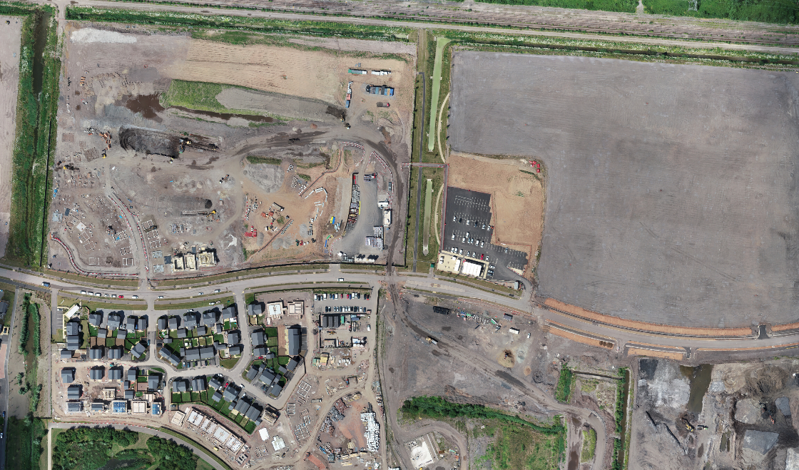
This service works particularly well with large sites where earthworks are on going, earth removal and movement, large developments, housing developments, planning for future development etc
- Birds eye view of all of the site within one image at an excellent high resolution
- With periodic mapping, groundworks and development can be assessed and managed over time.
Other services and uses
Orthomosaic photographs can also be rendered into 3D rendered images
Advanced drone photogrammetry surveys can also be provided with centimetre accuracy for more specific deliverables for your project. Contact us for more details.